Planning a Walkable and Bicycle-Friendly City (Local Government Unit)

Imagine our parents, children, students, women, wheel-chair bound persons with disability (PWD), and the people of a city/municipality in general enjoying and safely using their sidewalks, walkways, and bicycle lanes in their neighborhood. Close your eyes and picture this – Students having fun walking or biking to schools or playgrounds, employees safely biking to work, people going to malls and markets in their bicycles, our senior citizens walking safely to parks, and persons in wheelchair greeting each other in an accessible and safe pedestrian space. As planners, what can we do to somehow come close to this ideal place?

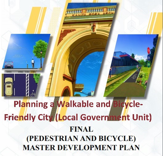
The City Government of Santa Rosa formulated its Pedestrian and Bicycle Master Plan (PBMP). The aims of the PBMP is to improve safety and accessibility of other road users by strategically providing quality walkway and bikeway network spaces and infrastructure for the people in the City.

The City of Santa Rosa hired an expert consultant to assist in the formulation of the PBMP. The Mayor created a Technical Working Groups (TWG) composed of members from the government, private sectors, and non-government organizations to work together in the formulation of the master plan. The objective of the city in formulating the plan is to check if the PBMP is technically feasible, acceptable and sustainable in Santa Rosa.

The strategies identified in the plan are the identification and establishment of dedicated or segregated lanes, hybrid or shared lanes, and facilitating short cuts or secondary networks.

The study revealed that the PBMP is feasible, acceptable and sustainable to the city. National government policies are also aligned with the PBMP aims and objectives.

The PBMP is aligned with Department of Interior and Local Government (DILG) Memorandum Circular (MC) 2020-100 (July 17, 2020) Guidelines for the Establishment of a Network of Cycling Lanes and Walking Paths to Support People’s Mobility and the Department of Public Works and Highways Department Order No. 88 series of 2020 (September 29, 2020) Prescribing Guidelines on the Design of Bicycle Facilities along national Roads.

The plan also supports the achievement of the eleven (11) of the seventeen (17) Sustainable Development Goals (SDGs) as follows:

a. Goal No. 1: End Poverty in all its forms everywhere.

Biking and walking are affordable and simple modes of transport enabling access to education, jobs, markets, and community activities. Biking and walking for some are the only affordable technical means of transport for people and goods thus lowering the expenses of the household.

b. Goal No. 2: End hunger, achieve food security, and improve nutrition and promote sustainable agriculture.

Biking and walking, in particular for the poor, help ensure access to food supplies, increasing their nutrition options and ensuring the sustainable transportation of food products.

c. Goal No. 3: Ensure healthy lives and promote well-being for all ages.

Biking and walking generate healthy and non-air-polluting lifestyles.

d. Goal No. 5: Achieve Gender Equality and empower all women and girls.

Biking and walking encourage governments to provide safe spaces/access for women and girls to schools, markets, and jobs.

e. Goal No. 7: Ensure access to affordable, reliable, sustainable and modern energy for all.

Biking and walking improve the energy efficiency of transport systems as it uses renewable human power in the most efficient way to move people and goods.

f. Goal No. 8: Promote sustained, inclusive and sustainable economic growth, full and productive employment, and decent work for all.

Biking and walking will open up a culture which will provide a very high potential for biking tourism and other healthy leisure activities.

g. Goal No. 9: Build resilient infrastructure, promote inclusive and sustainable industrialization and foster innovation.

Biking and walking enable people to switch from the use of individual motorized transport to a combination of active mobility (walking and biking) and public transport. Biking and walking will make it easier for the government to build resilient infrastructure and sustainable transport systems for economic development and human well-being, with focus on affordable and equitable access for all.

h. Goal No. 11: Make cities and human settlements inclusive, safe, resilient and sustainable.

Biking and walking are affordable, safe, non-polluting, healthy, and promote a sustainable economy. Biking promotes a sustainable transport system.

i. Goal No. 12: Ensure sustainable consumption and production patterns.

Biking and walking offer people the opportunity to move around in a sustainable way. Some goods can be delivered using bicycles. Possible increase in biking tourism will create more options for people to choose sustainable tourism.

j. Goal No. 13: Take urgent action to combat climate change and its impacts.

Walking/biking facilities are strong symbols of decarbonizing transport and communities; it offers immediate climate action.

k. Goal No. 17: Strengthen the means of implementation and revitalize the global partnership for sustainable development.

Biking and walking advocacy may promote effective public, private and civil society partnerships.

As early as 2007, Mayor Arlene Arcillas together with the Rotary Club of Sta. Rosa and Toyota Autoparts Philippines, Inc. launched the “Road Safety Academy” which is the first in the Philippines. Its objective is to educate students, drivers, operators, homeowners, etc. on the importance of following traffic regulations through a series of traffic seminars/orientations. The PBMP is a document plan that promotes Road Safety of all road users.

The PBMP ensures that the responsible people of Santa Rosa have the infrastructure and policy support in terms of ensuring a safe and connected bicycle and pathway system in the City.

The identified strategies and initiatives in the Santa Rosa Pedestrian and Bicycle Master Plan addresses the Santa Rosa’s call to promulgate the use of bicycle and walking as an alternative forms of travel not only because of its health benefits, but also its effect on the environment such as environmental protection, and reduction of greenhouse gas emissions while connecting communities the natural way.

The City of Santa Rosa PBMP was approved and adopted by the City via Sangguniang Panlungsod Resolution No. 0025 on March 2, 2020. Mayor Danilo Fernandez (2016-2019) continued the objective of Mayor Arlene Arcillas (2007 – 2016) on making sure that all road users in the city (including pedestrians and cyclists) can safely access important public spaces such as roads and streets. Mayor Arlene Arcillas (2019 – present) is again the Mayor of the City. Through the strong leadership of the Mayor, the policies of the National Government, the commitment of the city to the SDGs, and the programs, projects, and activities identified in the PBMP; it will only be a matter of time to appreciate Santa Rosa as a walkable and bicycle-friendly LGU.

Bikelanes and green pedestrian spaces are now being incorporated in road projects. Pilot areas are identified for establishment of bikelanes. I can see that more people are using their bicycles in their daily activities such as going to work or the market and leisurely during weekends and holidays. A culture of people using alternative and sustainable modes of transport such as biking and walking is inevitable to develop in the City of Santa Rosa. The City should continue to be aggressive in providing accessible and safe spaces to match the demand/need of our bikers and pedestrians.

How walkable / bicycle-friendly is your city/municipality?

Related Topics:

Addressing Traffic Issues without Building New Roads (but through Urban Planning)

NYC and LA – A Tale of Two Cities – Le Corbusier and Frank Lloyd Wright

Addressing Traffic Issues without Building New Roads (but through Urban Planning)

The knee-jerk reaction of most people when it comes to finding solutions in traffic congestion is to build new roads. It seems to make sense when you are stuck in heavy traffic and you’re thinking that what if there is an additional lane it will surely help make the travel faster. It means that big streets can accomodate more vehicles. But what if it is no longer feasible to expand a current street or construct a new one? What would be our recommendations/solutions to worsening traffic conditions?

If the street is congested, would it help a little if we take away one car/vehicle from that street? Probably not. What if we take away 100 cars from that street? Well, it may have an impact to the said street. What if take away 1,000 cars? Impossible? Preposterous? What if I ask you to contribute in lessening the traffic by taking away your car? Now, I crossed the line but just try to read on with an open mind and let’s argue later, okay?

If you take 100 cars away from the street specially those cars without passengers (driver only), there would be 100 people angry why they were not allowed to bring their car. But what if we put these 100 people in 2 buses or let us say 4 buses, that would mean that the spaces occupied by the 100 cars would be traded to the spaces that will be occupied by the 4 buses. That would free a lot of space in the street and loosen traffic flow. What if these 100 people have access and will ride a train, then the streets be relieved and will have more space for other vehicles. What if we take away 1,000 cars from the street? Well, it is the same logic.

We need to have a convenient, reliable, efficient and effective alternative way of travelling than using our own car. We need to have a compelling reason not to use our car. We need to have a good public transport system. These are public buses, trains, trams, and even ferry boats. Though buses occupy our streets, it carries more people and occupies less space than individual cars. Are you willing to commute than bring your car to help alleviate the traffic issue? This is with the assumption that there is a safe and reliable public transport system. But what if the transport system is not reliable? This is the best altenative so we really need to demand from our goverment better public transport system.

Last week I had an interesting discussion with a friend who is now working as a director in the Department of Education. One of our topics was the traffic congestion problem in our country. He told me that government leaders and planners should consider the education system strategy to address congestion. He told me about school districts and how this system discourage students in commuting far to schools. This help lessens road usage/volume and does not further add to existing congestion.

I remembered the neighborhood unit concept of Clarence A. Perry in 1926 wherein focal point of planning of a community is the elementary school. The school is centrally located in a way that students can walk when they go to school. This eliminates the need for students to ride the car everyday. If there are 500 students in a school and all of them have cars, it means that there will be 500 less cars using the street. Less cars means less traffic congestion.

This is with the assumption that there are ample and safe spaces along the road for the students to walk or use their bikes. Sidewalks and bikelanes are also part of a road. Pedestrian and bikers are also road users. If you are a parent and it is not safe for your kids to walk or bike, for sure, you will use your car to bring them to their schools. Roads should cater all road users and not only the motorists.

Click the link to learn more about the neighborhood unit: https://www.planning.org/pas/reports/report141.htm

What if expound on Perry’s neighborhood unit to include not only the elementary schools as focal point of planning but also universities, workplace, and commercial centers. This way, not only the students will be encouraged to walk/bike but also people going to work. Of course, the context will not be limited to a community setting but probably more of a city or town level.

I am fortunate to live in the fast-urbanizing City of Santa Rosa, Laguna in the Philippines. It is the Automotive Capital of the country where most automotive manufacturing companies are located. It is also home to multinational food and beverage companies. It is one of the leaders in the Information and Technology / Business Process Management in the Philippines. This means that people have the option to work within the city and to not add in the congestion of Metro Manila. Big universities are also starting to locate in the city.

Santa Rosa unknowingly follows some of the principles of New Urbanism. New urbanism (according to newurbanism.org) is the creation and restoration of integrated diverse, walkable, compact, vibrant, mixed-use communities. It includes housing, work places, shops, entertainment, schools, parks, and civic facilities essential to the daily lives of the residents, all within easy walking distance of each other. It promotes the increased use of trains and light rail, instead of more highways and roads. According to the website, at present there are over 4,000 New Urbanist projects planned or under construction in the United States alone half of which are in historic urban centers.

The general gist of New Urbanism is to promote access to facilities frequented by the people (schools, workplace, commercial areas, parks, etc.). The primary mode of transportation is by walking. This means there will be less car and traffic congestion in areas that follow the new urbanism principles. My city still needs to establish safe spaces for people to walk/bike. We just finished crafting the city pedestrian and bicycle lane conceptual plan. We need the people’s support to implement the said plan.

Click the link to learn more about new urbanism: http://www.newurbanism.org/

In 1955, Lewis Mumford said “Building more roads to prevent congestion is like a fat man loosening his belt to prevent obesity”. New roads induces more traffic congestion. But if we are going to make roads he stated that “Every urban transportation plan should, accordingly, put the pedestrian at the center of all its proposals, if only to facilitate wheeled traffic; But to bring the pedestrian back into the picture, one must treat him with the respect and honor we now accord only to the automobile: we should provide him with pleasant walks, insulated from traffic, to take him to his destination, once he enters a business precinct or residential quarter.” The roads we built should be complete with pedestrian and bike space facilities.

Search this site to learn more about Mumford’s thoughts on Transport Planning: sustainabletransportationsc.org › …PDF The Highway and the City – Campaign for Sustainable Transportation

Constrution of new roads is costly. The government will need to buy the Road Right of Way. What if the owner does not want to sell? Well the government can use its coercive power to oblige the owner to sell but this takes a lot of time. Constructing the road itself also takes time. By the time the road was constructed, the number of cars already exceeded the additional road space/volume.

In order to address traffic congestion, we talked about Perry’s planned neighborhood concept where a person’s daily activities/needs is available within his/her neighborhood. This was supported by the New Urbanism principles. Mumford directly said that new roads further induce congestion and that if we will build new roads we must include the needs/space for pedestrians on the new roads. We also need to demand for a good public transport service so that we have the power to decide whether we will bring our own car or use the public transport system – to be part of the problem or part of the solution.

Now, does it really makes sense to immediately construct additional lane or new roads to address traffic congestion?

Source of Image: https://www.researchgate.net/figure/The-Clarence-Perry-Neighborhood-Unit-diagram-of-1929-Note-the-size-roughly-1-2-mile_fig9_307746242

NYC and LA – A Tale of Two Cities – Le Corbusier and Frank Lloyd Wright

USA – East and West Coast. Is one better than the other? In the eyes of an urban planner from another country, the difference between New York City and Los Angeles City is probably one of the best examples of extreme principles in urban spatial planning.

My wife and I got the chance to visit both cities on December 2016 to February 2017. I took a long vacation from work to visit relatives in LA and NYC. It is both an enjoyable and informative trip. It is like studying two planning principles and actually living it in their model laboratories.

Broadacre City was an urban planning concept introduced by the famous American architect Frank Lloyd Wright which first appeared in his book “The Disappearing City” in 1932.

Broadacre City was designed to be a continuous urban area (horizontal development / not tall buildings) with a low population density. The city had a futuristic highway and airfields. There are living units (farm, factory, roadside markets, leisure areas, schools, and living spaces) assigned an acre (4,046.856 square meters) Living units were organized in a way that people can access any service or commodity within a radius of one hundred and fifty miles accessible by road or air. The design was motor vehicle-friendly.

My relatives in LA all have cars. Each person who knows how to drive owns a car. Personal cars are their primary mode of transportation such as when they go to supermarkets, malls, workplace, outlets, etc. They live in subdivisions in spacious two-storey houses with garages, backyards and laundry areas. I am not comfortable driving in a different country, fortunate for us, we now have Uber.

Charles-Edouard Jeanneret-Gris is known with his pseudonym Le Corbusier. In 1935 he introduced his theory on urbanism and published it in La Ville radieuse (The Radiant City) in 1935. He stated that housing should be assigned according to family size and not economic position. He envisioned building up (vertically/buildings) and not out (horizantal/spatial). His plan is also known as “Towers in the Park”, proposed numerous high-rise buildings each surrounded by green space.

I stayed with my sister in Jersey City for two weeks and was able to stay also in Upper East Manhattan NYC for another week (one of her friends went abroad and he let us stay in his apartment for one whole week). My sister that time doesn’t own a car. She doesn’t need one. We always use the subway and buses to go around and even tried the ferry when we went to Brooklyn. My sister rented a car when we travelled outside the city (Washington DC). Everywhere you can see people walking.

Most people in NYC lives in medium-rise apartments. Their living spaces are small. If the building does not have its own laundry area, you need to go out to a laundry shop to wash your clothes. Living spaces are small but the rent is expensive. This is because of the high housing demand in the city. The city is also famous for its Central Park. It is a public space where people can enjoy their day with different activities. It seems like the park is a communal backyard / relaxation area for the residents.

Which is better? It depends on your lifestyle and preferences. If you enjoy a fast-paced environment living with neighbors next door then NYC is better. If you enjoy the freedom of driving your own car and owning a bigger house then the City of Angels better suits you. I met people that lived in NYC during the peak of their productive careers and later chose to retire in the west coast. I also met young people dreaming to work and live in the Big Apple.

NYC / Le Corbusier or City of LA / Frank Lloyd Wright?

How about you, where do you prefer to work and live?

References / For Further Reading:

https://www.smithsonianmag.com/smart-news/how-controversial-european-architect-shaped-new-york-180965073/

https://www.biography.com/artist/le-corbusier

https://www.citylab.com/design/2012/11/evolution-urban-planning-10-diagrams/3851/

https://www.worldatlas.com/articles/what-is-a-broadacre-city.html

Image of Radiant City from https://www.archdaily.com/794582/the-stories-behind-17-skyscrapers-and-high-rise-buildings-that-changed-architecture/57cadef9e58ececab70000d5-the-stories-behind-17-skyscrapers-and-high-rise-buildings-that-changed-architecture-image?next_project=no

Image of Broadacre City from https://www.moma.org/explore/inside_out/2014/02/03/frank-lloyd-wrights-living-city-lives-on-conserving-the-broadacre-city-model/